Saturday, October 26, 2013

Mount Herman Loop

Today we went to Monument and hiked Mount Herman Loop.

We used Every Trail's directions, description and map of the hike (http://www.everytrail.com/guide/mt-herman-loop).  It is a pretty good description. I read many online comments about people who became lost on Mt Herman.  It made me recall the problems we had at Beaver Creek and I was wondering if I really wanted to hike this mountain! We found it essential to have a GPS because there are a ton of trails that branch off of this one and it was extremely useful to compare our track to the one we downloaded.  I think we would have gotten lost without it, but it was easy with it.

It was windy and cold at the start of the hike, but we didn't hike far before the extra layers came off. It will get close to 60 degrees today.  This wind flag was in front of the parking lot we parked in - the first one we saw after turning onto Red Rocks Drive from Herman Rd.


Here are the stats from our GPS:

Distance: 8.9 miles
Elapsed Time: 4:48
Elevation Gain: 1121 feet
Total Ascent: 2315 feet
Average moving speed: 2.2 mph  Max 4.4 mph

We somehow missed the fact that we were to hike the road (Mt. Herman) up and so initially we were a little confused.  A check of the track Willy downloaded on to our GPS and we knew we were good.  One thing Every Trail didn't mention is that the first three miles are uphill. The incline of the road was gradual though and not difficult -- we tolerated it very well. Plus, because it is a road, the walk was level and not as demanding as climbing up an uneven trail. There were some nice views glancing down.  You can see the road we just hiked up on the left side.

Here is evidence that plants are very hardy and can grow just about anywhere. The roots are grown right into the rock.


Towards the top of the road where trail 715 departs from Herman Road there is a shooting range - at least we heard lots of gunfire.  See the "No Shooting" sign with all the bullet holes in it?  This was a sign of things to come.

We hiked a little more uphill from the trailhead and then started into Limbaugh canyon. Here's a site we don't often see on trails:
A burned out car.  Wonder how that got up here? When we got to a nice rocky spot further down, we decided to take advantage and have a small snack - grapes and cheese -- our favorite.  When we were nearly finished, I heard a bullet whistle over our heads.  I looked at my husband and he confirmed what I thought.  Then two more.  I would have been happy to get off the mountain at this point.  "Hey, there's people down here." I yelled. I would have hiked back the way we came except that was where the shots were coming from. We continued on down the trail, talking a bit louder to make our presence known, and soon walked out of range. It was a little too close for comfort, but now that I'm safe at home I'll admit that I've never heard bullets whistle past before (just like on tv) and that was an experience.  lol! Willy thought these shots had ricocheted off of something up at the shooting range.

Now we are really enjoying the beauty of the canyon not to mention that much of it is downhill which after three miles up is much appreciated.  Much of the trail is covered with a carpet of aspen leaves.  This bridge was NOT to be trusted. lol!

There was a little tiny creek (Monument Creek) that trickled along side the trail and as we walked it was growing a bit bigger.  We had to cross it several times.  Luckily it wasn't very wide, maybe 6 feet or so at its widest and there were either rocks to skip across or trees laid across for us to walk on. Our walking sticks came in VERY handy here! This was the first crossing.

We were surprised to see that there were still some aspens with color left.


We left the woods and entered into a meadow.  We saw plenty of prairie dog mounds, but no snakes!


This trail is popular with mountain bikers.  They looked like they were really having a good time! We did not see any other hikers.


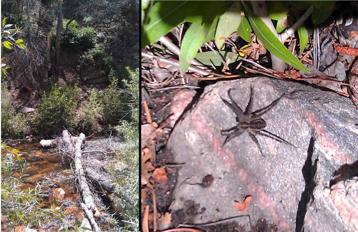
We eventually hiked back into the woods where there were some really large boulders with the creek running through them.  It was very pleasant to hear the bubbling water.


And there were more creek crossings. The second picture actually shows 2 crossings, one on the left and one about 20 foot further where we crossed back again.


A couple of times we saw snow on the path. We were on the shady side of the valley all the time through here -- it felt good -- you get pretty hot hiking.  At Everytrail's Point of Interest 7 we saw Trail 715 Palmer Lake overlook which is so pretty it startles you when you come upon it.


This is a nice view of the south side of Spruce Mountain which is also a very nice hike. It's scary when you can recognize mountains by name.  lol!

 
After this you have a couple of trail changes - HZ and White Ghost.  Both of these are marked with a sign post.   HZ has you climbing again to avoid private properties.  This trail is very rocky and was hard on my ankles.  I started to trip up on the rocks.  My walking sticks saved me a couple of times.  I'm guessing I wasn't stepping high enough because my legs were pretty tired at this point. Willy was fine. There was some pretty fall colors here still, especially with the light shining through the trees, and woody woodpecker made an appearance.


Close to the end there are some enormous red rocks that are pretty impressive.  Around the corner we found some pretty jovial bikers, one who had popped his tire and was replacing it.


At the end of the hike we saw these leafless bushes that look like they have been lit on fire by the colorful grasses.
 

When we arrived at the end of the trail it met Red Rocks Dr and there was the parking lot, but not our car!  Yikes! Looking down the street we saw a second parking lot and our car. Whew! The flag on the pole is still now. This hike had a little bit of everything and it's closer to home than some of the others. I can think of a time when the intensity of this trail would have given us pause, but we are feeling pretty good about it! You could shorten this hike by driving up Mt Herman Rd.  There is a small place to park at a trail head shortly before you get to the trail head for trail 715.  Of course you'd have to have two drivers, one to park at the lot where the trail drops you off at the end and one to park near the trail head for trail 715. It would cut off about 3 miles (of uphill climbing) I think.

Thursday, October 24, 2013

Beaver Creek Loop - The hike to change all hikes

We decided to do this hike based on the description here:  http://www.everytrail.com/guide/beaver-creek-loop  It is everything described here and more.  There are also good directions to get to the trailhead along with a play by play description of the hike.  Good information.  To bad we didn't study it a little harder!  This hike was a little longer than we have been doing, 7.3 miles, but we felt we could do it easily seeing as we had done the comparable length Waldo Canyon many times.  The last time we hike Waldo Canyon we finished in about 2-1/2 hours and we expected the same here.  I fully expected to join my sewing buddies back in Colorado Springs at 1:00pm seeing as we got an early start.  Ha ha!

On our drive to the trailhead over the dirt road we were delighted to see several wild turkeys.


Here is where the trail starts:


We packed as we always do -- backpack with snacks and a large water bottle for each of us.  As I'm recalling this from memory I wouldn't use my description as a guide!  The first hour or so was a very enjoyable hike.  The trail was wet in parts.  We laughingly joked about this being our first creek crossing.


Some ups, some downs, some parts of the trail were rocky.  The rocks made progress slower going for us.


We also walked through a valley that had more undergrowth than we are used to in Colorado.  It was also very moist and close enough in one area that we could feel the moisture of the weeds brushing against our legs.  In this area we were bothered by mosquitos - another rare occurrence in Colorado.  Luckily I just happened to have some spray so I got it out -- first and only use so far!  While we were put-zing around, I looked around and there was a lovely deer looking down at us.  It ran away before I could snap the magestic frontal photo.

We had only a small while left of this blissful hiking adventure before it turned ugly.  Here are some images so you can enjoy it too.  In some places there were lovely wildflowers.  This is very different terrain than the rocky cactus scenery we hiked from to get here, but no less or more beautiful.


At a sign we turned left onto Powerline Trail.  This was the beginning of an endless uphill climb.  Luckily we are starting to get used to these, especially after hiking section 16.  Although long, we tolerated it quite well.  Towards the top we were treated for our efforts with exquisite vistas only God is capable of painting. I got a text from my friend asking me if I was going to make it to sewing.  I text-ed her a photo and told her I would when I got off the mountain I was on.


After hiking at the top for a while we descended for a bit and then climbed back up to another crest.  Then we began a long continuous downhill trek.  It was steeper than the climb up which traversed back and forth across the hill making it easier to climb, but not too steep to make the climb down very difficult.  There were some spots where the trail became questionable - like where was it and is this really where we are supposed to descend?  There were some beautiful views of rocky mountains that for some reason I didn't take pictures of.  I think I was reveling in not climbing up -- a lovely feeling that is only slightly dampened by the new muscles you are using to go down.  (-;  My husband didn't have the best shoes at this point in our hiking adventures and later his toenail turned purple from constantly hitting the front of his shoes.  Next stop - new hiking boots.  (-;

Some parts of the trail are well marked.

 Unfortunately, others are more simply marked.
I seem to remember seeing a cairn of rocks like this with a less defined trail branching off of it.  We have seen this many times while hiking and have always taken the road more traveled so I thought nothing of it.  Plus we were still on the high of going downhill.  (-;  Until we got to here.

This is the end of the trail and where two creeks merge.  Yes, the end of the trail.  So this is where we pulled out our printed instructions and realized we probably should have turned off a while back.  There was NO going back from my point of view as I clearly remembered the joy of downhill that lasted seemingly forever (without any switchbacks) and suffered no delusions about what hiking back up it would be like. There was no option to follow the stream on our side of the stream because the stream ran into a rock face.  So we took off our shoes and crossed stream one first and then stream two.  We thought it was better to have some rocks for balance or we could have just crossed the single merged stream.  I had to gather courage for this.  I am diabetic and was not fond of the idea of crossing in my bare feet.  The rocks under water are slippery.  We made it to the other side and there was a wide open spot between trees where it looked like people had camped.  We tried to find a trail but there was none and eventually we ran into thick brush and couldn't proceed.  Our only option was to cross back over the stream again.  We were able to cheat a little (using a downed tree) and didn't have to take off our shoes again, plus we found a stick to cross with.

We still couldn't find a trail so we just followed the creek for a while which wasn't too difficult to do.  I had downloaded the track to my phone, but it was starting to run out of charge.  Didn't make us happy.  For one, we weren't really sure where we were and if we were proceeding correctly.  We kept running into rock faces and had to cross the creek again.  So, we took off our shoes, crossed the creek, put back on our shoes and hiked until we could hike no more.  Then we'd cross the creek again.  At one point we had just crossed the creek, put on our shoes, and 20 feet later had to cross again.  It doesn't sound like it would be difficult to take off your shoes and put them back on, but it was tiring to do it again and again, especially after the never ending uphill climb we had made.  Plus, being sort of lost, the stress was getting to us.  We were reasonably sure we would make it back to our car, but not entirely sure.  The desire to get to a point where we were sure made us want to press on and not take proper breaks.  I read that you also go faster and tire yourself out when you are stressed.  Not to mention that some crossings have their own crossing guard like the huge wolf spider below.  We tried to find places to cross the stream where trees had fallen (or been dragged across) or where there were large boulders to hang on to.


At one point I became so frustrated upon realizing we had to cross the stream one more time I sheepishly admit that I started crying.  My husband, afraid I was going to give up, told me harshly to "Stop it right now".  I responded by ... crying harder.  Hugs all around.  (-;  It was in that crossing that I fell into the stream.  Instead of quickly jumping out, I sunk into the coolness of it.  It was refreshing in the heat.  It wasn't until later I realized that I actually hurt myself.  My elbow hit a rock and later I looked down to see it was swollen to the size of a golf ball. I could move my arm alright, but it hurt to touch it. If I wasn't in such dire straights I would have enjoyed the scenery more. Gorgeous!

A couple of times we thought we'd found a trail just to follow it to a dead end. More frustration. Finally we did find a trail (yay!) and started to follow it. More uphill climbing and I am barely able to put one foot in front of the other. At one point we came close to the creek again and I poured a bottle of water over my head and it gave me a second wind. I think I was hotter than I realized and the heat was affecting my ability to proceed.  I had no hat - not smart. This trail is further south where the heat is usually a good 10 degrees hotter than we are used to. We finally hiked up to the trail where we remembered seeing a sign post early on that we could have hiked down to the creek near to the beginning of the trail. It was such a relief to be in familiar territory. Good thing as we were nearly out of water and hadn't been able to drink as much as we wanted. It was a longer hike to the car from here than we remembered. We ran into two women hiking in - the only people we saw all day. It was about 3pm in the afternoon by the time we got to the car. Two things I remember -- one was that I was being eaten alive by mosquitos waiting for my husband to change shoes.  The other was how grateful I was that he thought to pack a small cooler with fresh drinks in the trunk of our car. I was so thirsty and it just saved me.

This hike shook my faith in myself. I made the decision that I would make sure my bag was packed for any contingency. Major lessons learned:  Find out all you can about the trail your hiking before you go -- read any instructions carefully to know what you might face. Have a topographical trail map and check landmarks around you before you start your hike. We didn't know how close the creek was to our car and so weren't sure if the creek would lead us to the trail head. We thought it would eventually lead us to somewhere civilized. You can also check your landmarks for bearing if you feel you have gone astray from your trail.  Have a GPS so you know if you are returning to your starting point. However, a GPS can show you that you have to hike from point A to point B to return to your starting point -- what it doesn't tell you is that there is a rock face you can't hike through -- great reason to keep your topo maps. Have good hiking shoes. Carry extra water for hikes new to you. Wear a hat to protect you from the heat.  Know that bug spray is sometimes necessary in Colorado.  Water socks and hiking sticks would have been nice to have while crossing the creek. Be prepared for an overnight stay in case someone gets sick or hurt. These days we are much better prepared to hike in the mountains.

Sunday, October 20, 2013

Elder-Fehn Trail

Total distance: 5.4 miles
Elevation – Min: 9442 ft, Max 9956 ft.
Total Ascent: 1930 ft.

We wanted to hike a longer hike today and intended to hike the Elder-Fehn Trail to the Vayhinger Trail and then follow the Ring the Peak Trail to Limber Pines Trail, but when we got there we discovered that the North Slope Recreation Area (NSRA) was closed from 1 Oct to 1 May.  We were still able to hike the Elder-Fehn Trail. 


This trail can be reached by traveling west on hwy 24 from Colorado Springs just past Woodland Park and then taking a left onto Edlowe road.  At the end of this road there is a parking lot with a restroom and this is the trail head.  On our drive to the trail head we saw a bunch of turkeys with an excellent backdrop of Pike's Peak.  I didn't bring my camera today so was limited to using my phone for pictures, but I got this excellent shot:


Initially we climbed about a tenth of a mile or so where Elder-Fehn Trail branches right while to the left is a locational sign and a gate which leads to Limber Pines Trail in the NSRA.  We took the right (the left was  closed) and were surprised to see that there was snow on the trail since we had hiked Dome Rock the week prior and not seen snow.


There are a lot of ups and downs to this trail with occasional views of Pike's Peak which was snow covered today.


 There were only a few aspens left with any color to them.  Much of the sky is cloud covered, but there is some blue sky showing.  When we checked the weather this morning Woodland Park was supposed to go cloud covered by 11:00 and have a 60% chance of snowfall by 4:00 although not much was expected.  When we started at 8:45 it was about 36 degrees.  I had 4 layers on top and 2 on the bottom.  Within 30 minutes I had shed two layers on top, ditched my gloves and snow hat.  I still wore a visor.  Most of the trail goes through a wooded area.  At one point the trees thin out and it becomes fairly rocky.  We stopped here for a snack.


Just past this point we noticed some turkey tracks, so apparently the turkeys do some mountain climbing of their own.

There are all sorts of signs telling you to stay on trail.  The trail is also marked on trees with reflective disks at eye level. 


Eventually we passed the sign for Vayhinger trail to the left.  It wasn't blocked off, but you could have only hiked down it for about a mile before it would have entered into the NSRA and been closed.  We aren't sure why the NSRA closes their trails from Oct to May.  We circled around the loop and headed back the way we came. This was a fun hike and we'll do it again; maybe in the summer when all the trails are open for hiking.